Mont des Morios Trail
The Mont des Morios Trail is the jewel of the free territory. Known locally for generations, its silhouette is clearly visible throughout the Charlevoix hinterland. Once on the summit, you can enjoy a breathtaking 360° panorama. The entire Charlevoix crater is visible and, on a clear day, the St. Lawrence River and certain villages of the Bas-Saint-Laurent.
Length: 5 km
Difference in height: 500 m
Level: Advanced
Winner of the 2015 Trail of the Year Award from the Fédération québécoise de la Marche (now Rando Québec)
GPS data
**hiking season on mont des Morios start around June 10th and end with snow, see FAQ.
*****It is forbiden to camp on the SOMMETS MORIOS SUD ET NORD****
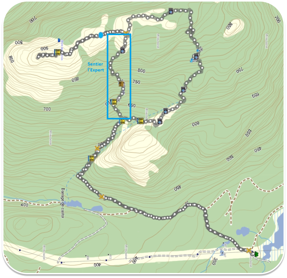
It is possible to take 2 paths to reach the summit: the normal path and the Expert path. See map below: